Black Bear Pass Trail - Epic Colorado Adventure
- Daniel Forster

- Jul 2, 2025
- 7 min read
Updated: Aug 1, 2025
Black Bear Pass Trail open! UPDATE for July 2025: Black Bear Pass is open for 2025!!! The office release came on July 2nd, 2025, on the San Miguel County Colorado Road and Bridge Facebook page. Please be careful out there, the traverse past the one-way sign down into Telluride is not a walk in the park. More details about my journey and some crashes on the pass in past years below.

I saw an alert today, in July 2024, that the infamous Black Bear Pass Trail opened. Yes, Black Bear Pass Trail is open all the way down into Telluride. This is significant for a few reasons. The first is that in 2023, the west side of the of the pass never opened. For whatever reason the San Miguel County didn’t open it officially. Unofficially, there were some people that made the trek and even one vehicle that got stuff on the ‘closed’ section. Which made the local sheriff pretty upset.

The other reason this is significant is this is one of, or arguably the most dangerous “road” or trail in Colorado. Just a few articles about it:
I’ve only seen a few stories of people dying, however there have been lots of jeep accidents (and others of course). Just a few examples in recent years.


The last reason this news is significant, is this trail if very popular and gets busy in the summer. One reason is that Black Bear Pass is a Jeep Badge of Honor Trail, which is a big deal in the off-road community. The trail can only be opened when the snow has melted or been cleared. So summer is the time to go.
A few years back, I had done some research and knew that I didn’t want to go on this trail. There were enough stories on YouTube and other trails reports that I had no desire for it. That is until I got a message.
My friend told I should go up the Black Bear Pass trail. I told him what I just told you. He said the wildflowers are amazing and you can see them before you get to the dangerous part of the road, then just turn around and come back. Of course, I couldn’t pass up the wildflowers for landscape photography and capturing Black Bear Pass photos for new prints. So, with that little information and a desire to capture photos of epic wildflowers, I started up the east side of Black Bear Pass.
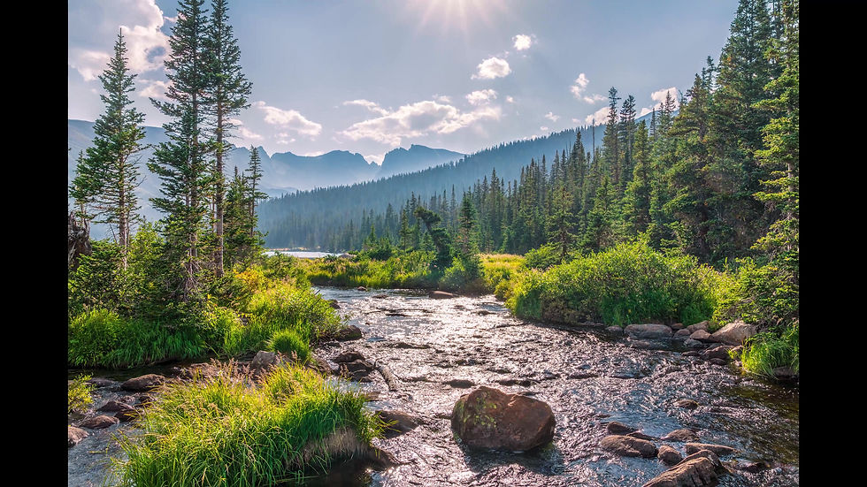
The wildflowers were indeed epic, and so were the views. There were wildflowers and view of mountain peaks, waterfalls and the Red Mountain Pass below, all just heading up the pass.
Once I arrived at the top, the views were even better. You can see the Red Mountains, alpine ponds, and 20 miles south past the Grenadier Range.

The views from the top of the Black Bear Pass trail are out of this world!

These views are worth the trip alone.

So, I stopped and took pictures along the way. I arrived at the top and knew that I had to continue partially down the west side to get to the best wildflowers. I found them and took lots of Black Bear Pass photos from the top.

I didn't see a ton of wildlife, but if you pay close attention, you can see a nice variety on the way up. As well as a bunch of Marmots scurrying across the road along the way.

Was it time to go back, or follow my endless curiosity of what was just over the hill and the next bend? Of course I continued the trail. All the while relying on the advice of my friend, “you can turn around at the one-way sign”.

I was making my way around the shelf road and enjoying every second of this spectacular journey. That is until I realized that I had just gone down a rocky section of the trail that I knew I could not get back up! My heart started racing and weighed my options, rechecked the trail and decided to keep going. I thought, “how back could it be?”.
The trail got worse, more large rocks and drop offs. I finally arrived at the top of the most famous section. On the right is a rock wall. One the left is a cliff down into a steep gulley. I pulled off the road to catch my breath and assess the situation. To add some more drama to this situation, a massive thunderstorm started heading into the canyon. We are talking heavy rain, hail, lightning, yep, all of it. At this point, I was probably the most terrified I’ve been in my adult life.
Not more than a few minutes after the storm started rolling right over me, a 4-door Jeep comes rolling very confidently down the trail. The gentlemen looked over at me, and back at the trail and keep on going, never slowed down a bit.
A few minutes later another truck came down. He parked behind and after the rain stopped, we got out and chatted for a few minutes. I told him I wasn’t supposed be that far and wanted to turn around at the sign, but I didn’t see it. He showed be a picture of the sign. It was all scratched up and unreadable. Then he started down the trail. His truck had smaller tires than my FJ, so I figured if he could make it, then I could. I wanted to watch what lines he was taking, so I quickly followed.
I had been on quite a few 4x4 trails before this, so I knew pretty well how my FJ behaves and how to take certain kinds of lines. The biggest challenge this this section is that it is off-camber and there are rock shelves to deal with, also known as the 'Black Bear Pass Steps'. There were a few hair-raising moments, but I made it through that section with no issue. The gentlemen pulled over and I asked he was good. He mentioned he was checking for damage because he scraped very hard a few times, yikes.
At this point I continued down the famous Black Bear Pass switchbacks. I hadn’t taken any photos along the sketchiest parts of the Black Bear Pass Trail, probably because I was so sketched out and didn’t want to think about anything but getting down. But now I was confident I could make it and really could believe the epic views; I got my camera out and took a few shots.


All it all, it was an amazing experience. And for the record I would not do the west side again in my FJ Cruiser. A lifted vehicle and larger tires (35+) are very helpful.
If you are interested in taking the trail, Dewie Jones over at Colorado Mallcrawlers made trail guide on Youtube that is helpful to get a better idea of the trail.

Check out my Colorado Landscape Photography and Nature prints in my Portfolio of work.
Do you want to know what camera gear I use? I have it listed on my Gear Page.
Frequently Asked Questions (FAQs)
Q: Is Black Bear Pass Open in 2025?
Yes, Black Bear Pass is officially opened for the 2025 season! The San Miguel County Colorado Road and Bridge organization has cleared the pass for travel by vehicles capable of the journey.
Q: Is Black Bear Pass One Way?
Partially. The stretch from Red Mountain Pass to the top of the pass, and even down the east side for a few miles is bi-directional. So, you can drive up to the top of the pass from Red Mountain Pass and back down. The most famous section heading down into Telluride is on the East Side. This section is One Way. Once you pass the one-way sign, there is not going back. The sign is just past the turn passing by the old Black Bear & Iona Mine site. Rough GPS coordinates are: 37°55'14.2"N 107°44'43.5"W
Q: Is Black Bear Pass Dangerous?
This question is relative to your driving skills, experience and the vehicle you drive on the pass. I personally have not had a problem driving my FJ Cruiser on the pass. However, I would recommend your vehicle to have at least a small lift and 35" tires for a good experience. I have also been on many other trails in the San Juan Mountains and would recommend some experience on other trails before going on Black Bear Pass.
Q: Where is Black Bear Pass Colorado?
Black Bear Pass starts at the top of Red Mountain Pass in Colorado at mile marker 80 on Highway 550. The entrance to Black Bear is 13.1 miles and 27 minutes south of Ouray, Colorado. From the south, it is 10.3 miles and 17 minutes from Silverton, Colorado. You will see multiple signs for the entrance at the pull-off area. Rough GPS coordinates are: 37°53'48.0"N 107°42'48.0"W
Q: Has there been deaths on the Black Bear Pass Trail?
Yes, there have unfortunately been people that have died. However, most of the accidents that have occurred on Black Bear Pass only resulted in injuries. Albeit serious injuries in multiple well covered stories. Like this one on Youtube: https://www.youtube.com/watch?v=2R5cLghSWGQ
Q: Are there any online video trail guides of Black Bear Pass?
Yes, there are multiple online guides. This video from Mall Crawlers will give you the details and visuals you need to make the trip: https://www.youtube.com/watch?v=gdz9VQ0b3rc
Yes! Thanks for asking. Please see my portfolio of my Colorado Landscape Photography Gallery to see my photos I have for sale.
More questions, comment below or reach out to me.


Comments